

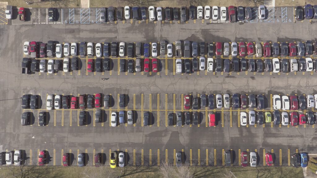
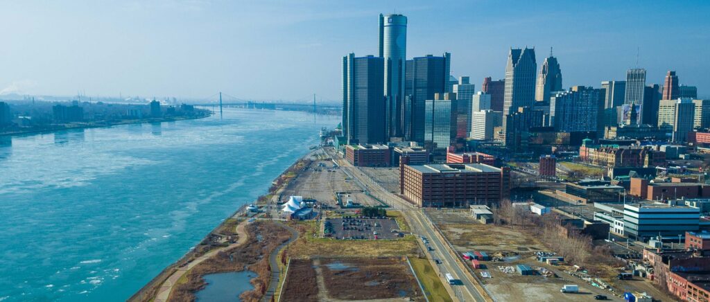
Nadir image taken from the Detroit waterfront parking study
I patented a drone-based process to create hourly photogrammetric maps, building a spatiotemporal dataset for training computer vision models to analyze urban parking behavior. This approach integrates colorimetry and was developed alongside Michigan city planners.
Quantifly advertisement showcasing our novel concept
Urban planning in America faces mounting challenges as cities evolve and demand for efficient space utilization grows. From commercial expansion to green spaces and bike lanes, city planners are balancing competing priorities—and parking stands as one of the most persistent issues. To meet this challenge, I co-developed a drone-based approach, Quantifly, that brings cutting-edge technology into the planning process, revealing new data insights that can reshape urban spaces.
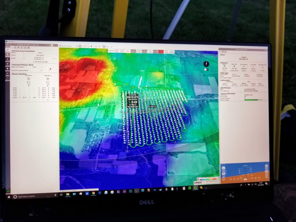
Using eMotion aerial mapping software for flight planning our aerial testing

Installing an RTK antenna and image metadata module onto an Inspire 2 for real-time image geotagging
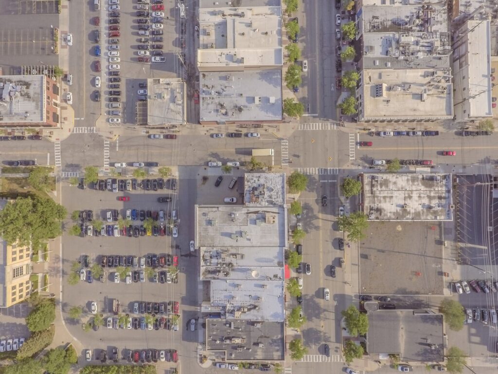
Nadir aerial photos taken with drone for parking study prototype, Royal Oak, Michigan
My journey began in an unexpected place: the film industry. Between 2014 and 2016, I worked with drones on various film and television projects for companies like Netflix, BBC, and HBO. From capturing sweeping landscapes to precisely choreographed shots, drones became a powerful tool for creative storytelling. This experience, combined with my interest in photogrammetry software like Pix4D, sparked an idea—could drones capture more than just captivating shots? Could they capture and analyze critical data?


Fine tuning our computer vision model for parking study minimum viable product
With city planning in mind, I explored various drone mapping techniques, from mapping muskrat lodges in Iowa to monitoring wildlife habitats in Idaho. I even collaborated with researchers on projects that used thermal imagery to study animal populations. While these applications offered a learning foundation, I discovered that urban planning presented a uniquely promising area for drone-based data analysis.
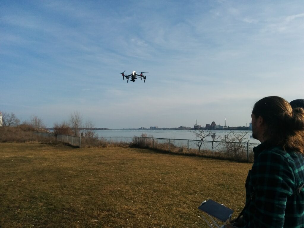
Mission area for Detroit waterfront aerial mapping project 2019
In partnership with Dr. Javad Rustaei from Wayne State University, we explored how drones could conduct automated flights in grid patterns, capturing comprehensive data on urban areas. At one point, we partnered with Wayne State University and NASA in a project aimed at analyzing algae blooms in Lake Erie. This partnership not only honed our skills in data analysis but also deepened our understanding of drones’ potential in environmental monitoring.
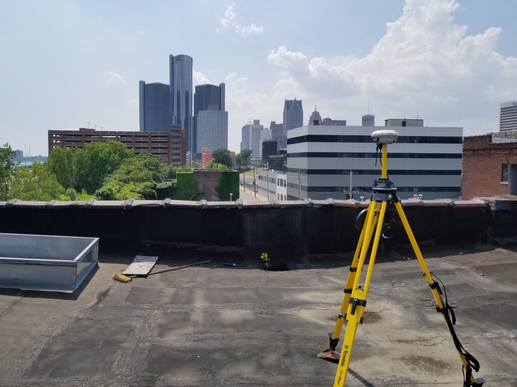
Establishing ground control points in downtown Syracuse, NY for aerial photogrammety
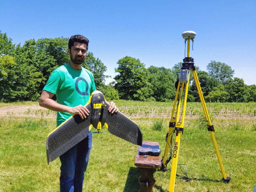
Our intern Kartik Joshi setting up an RTK fixed wing system for testing. We hired Kartik through Syracuse University’s CASE internship program
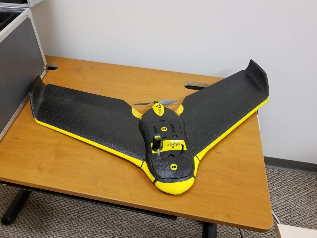
The eBee RTK fixed-wing drone system
The turning point came when we realized the unique potential for drones in urban parking analysis. Traditional parking studies typically involve a team of experts manually counting cars over several hours—a process that’s time-consuming and costly. Using drones, we developed a process that allowed us to gather aerial images every hour, creating 12 high-resolution maps daily. We processed these maps with advanced photogrammetry and computer vision models, creating a spatiotemporal dataset that captured parking patterns across time.
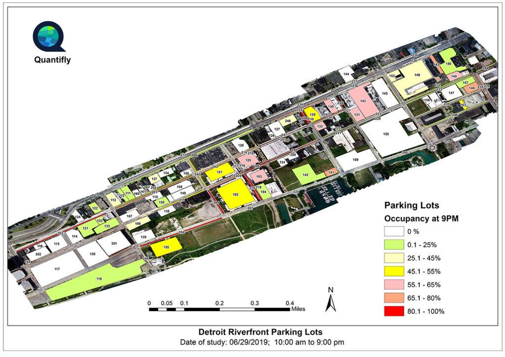
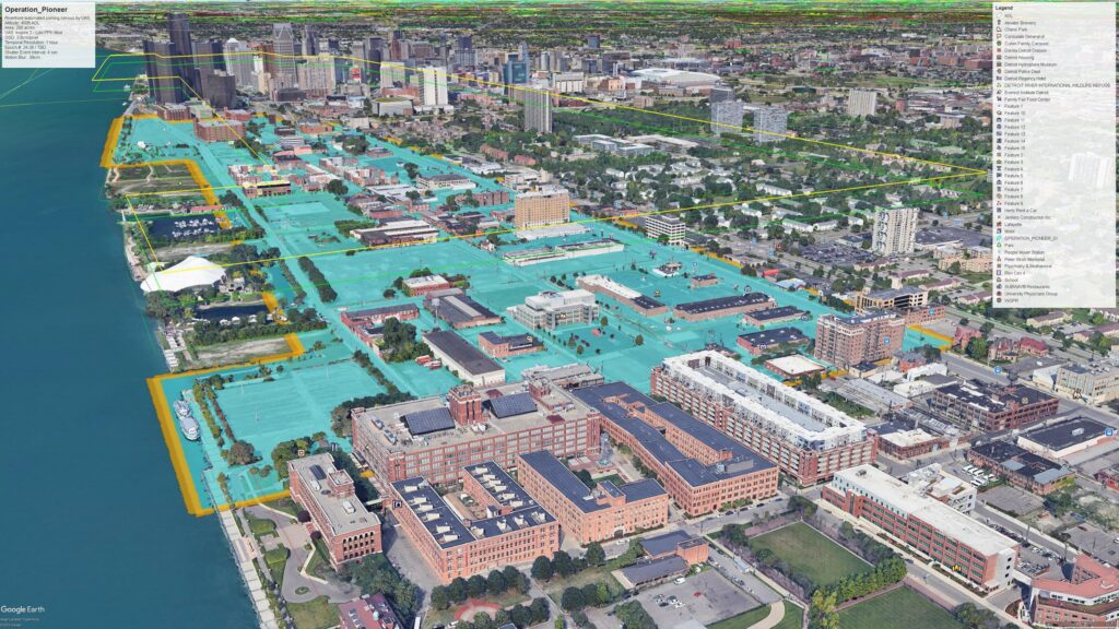
Quantified results for the Detroit waterfront parking study for APA presentation
This solution wasn’t without challenges. Scaling up meant addressing FAA regulations, securing waivers to fly drones over populated areas, and navigating the logistical hurdles of gathering data across multiple city blocks. Yet, the results were remarkable: we were able to automate the analysis of parking spaces, detect peak times, and reveal inefficiencies in parking utilization. This data can empower planners to make informed decisions, from adjusting parking capacity to reallocating spaces for bike lanes or green areas.
Quantifly’s success led us to the Genius NY Accelerator, the world’s largest autonomous systems accelerator, where we secured $600,000 in funding, along with grants and resources to further refine our approach. The financial support was critical in advancing our drone system’s capability, especially in terms of image processing and model training for urban parking analysis.
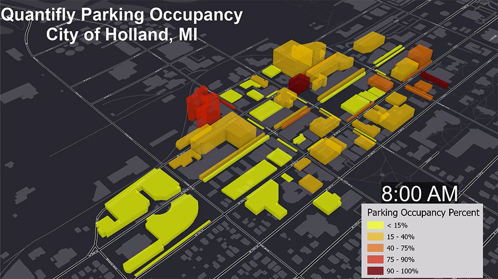
Using ArcGIS to represent parking density in downtown Holland, Michigan
Our work also underscored an important lesson: parking is more than a simple convenience—it’s a critical factor in urban design. In many U.S. cities, parking occupies up to one-third of urban land, much of it covered in asphalt or concrete, which complicates water drainage and contributes to urban heat islands. By revealing usage patterns and inefficiencies, our drone data enables cities to envision alternatives, from permeable surfaces to green spaces that offer environmental and community benefits.

Parking data insight revolutionized with aerial mapping in Grand Rapids, Michigan
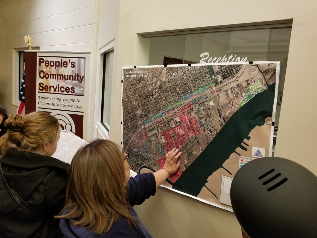
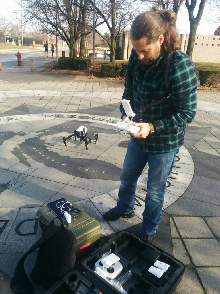
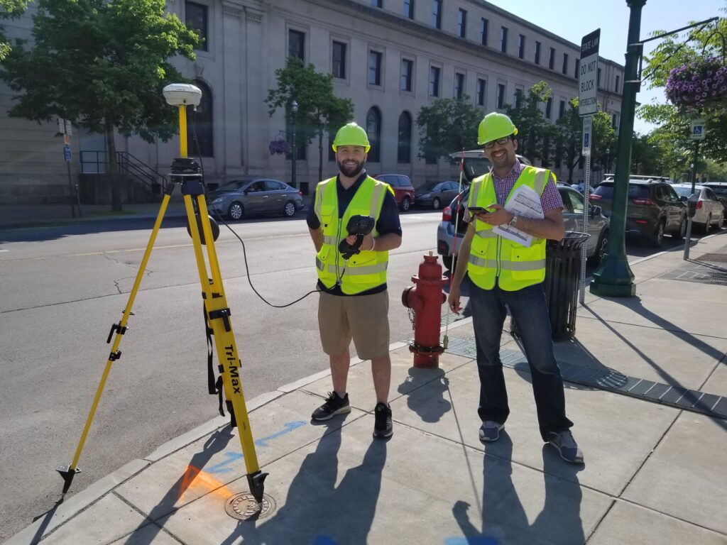
We worked closely with communities in Detroit during the conceptual phase
Quantifly continues to operate today, aiming to tackle urban challenges through data-driven insights and machine learning. My time with the company, though brief, left a lasting impact on my approach to technology and its potential in rethinking city spaces. By examining parking through a technological lens, we can pave the way for more efficient, livable cities that meet the needs of people, not just vehicles.
